We are among the luckiest people when it comes to enjoyment of the outdoors--the Garden of Eden is practically in our backyard! Known as the Columbia River Gorge, it is a land of steep cliffs sliced by plunging ravines, all laid down by flowing lava several millennia ago. Ice age sculpting left its mark, and now hikers delight in the rushing rivers, pounding waterfalls, enchanting old-growth firs and cedars, all softened by lush leafy greenery.
In 1922 the Columbia Gorge Highway was completed, once known as "the road that could not be built." After the road went in, trails and campgrounds were developed to give the newly mobile a destination. I haven't had a moment to reference Trill's diary, but it wouldn't surprise me if Ruby and Trill (Craig's grandparents) stopped here on their 1924 trip.
Eagle Creek Trail is one of scores of hiking trails that wind through hundreds of square miles. On my birthday weekend Craig and I backpacked up the creek, and here is some of the beauty we experienced.
First, here we are heading out from the trail-head. Craig carried a pack too, by the way. Mine weighed 30 lbs., his was 40. He got to carry the tent!


NOTE: all photos were taken by us except the one of Metlako Falls.
In 1922 the Columbia Gorge Highway was completed, once known as "the road that could not be built." After the road went in, trails and campgrounds were developed to give the newly mobile a destination. I haven't had a moment to reference Trill's diary, but it wouldn't surprise me if Ruby and Trill (Craig's grandparents) stopped here on their 1924 trip.
Eagle Creek Trail is one of scores of hiking trails that wind through hundreds of square miles. On my birthday weekend Craig and I backpacked up the creek, and here is some of the beauty we experienced.
First, here we are heading out from the trail-head. Craig carried a pack too, by the way. Mine weighed 30 lbs., his was 40. He got to carry the tent!

Not a great shot, but you're looking at spawning salmon in the creek. They leave the Pacific, swim up the Columbia River, mysteriously find the stream of their birth, lay (or fertilize) their eggs there, then die.

Eagle Creek trail-head sports several Depression-era structures built by the Civilian Conservation Corps. Pretty good-looking for being almost 80 years old.

About 1.5 miles up the trail is the first waterfall, called Metlako Falls, named after the Indian goddess of salmon; height: 100 feet

Just under 2 miles in, Lower Punch Bowl Falls, 12 feet high and 30 feet wide

And Upper Punch Bowl, 33 feet high; some of you will recognize this falls.
In the summer it's busy as grand-central station here, being a favorite destination for nearby Portland residents. I have spent many happy hours here myself.

About 3 miles in, Loowit Falls (another Indian name); it drops 60 feet into a perfect pool, which is slightly hidden in this photo. Some burning hot summer day, I'll figure out a way to get down there to soak in that little pool.

Eagle Creek Trail crosses the creek several times over on bridges like this one at the 3.3 mile point, called High Bridge.

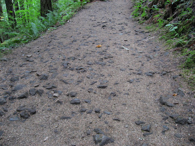
The trail is pockmarked with volcanic basalt rocks; hikers are happiest when they wear sturdy boots.

Lunch at 4-Mile Bridge.

Grand Union Falls, about 5.5 miles in; 45 foot drop. A mile before this one is Schoonichuk Falls with its 55-foot drop (sorry no photo).

And at 6 miles in, the grand-daddy of them all, Tunnel Falls: 130 foot drop into a small pool; look closely to see Craig standing on the cliff edge. No worries, there's a steel cable drilled into the rock here (and in other key places on the trail) for hikers to grab.


Here's a video of the falls showing its entire length:
The tunnel that takes you behind Tunnel Falls.

Twister Falls, about an 80 foot plunge here; counting the upstream series of smaller falls leading to this one, there's a drop of 140 feet in about a hundred yards. The trail in this area is called "the vertigo mile."

Seven-Mile Falls plunges 40 feet into a pool.

Trail hazard--a shattered cedar blocking the way. Speaking of hazards, this is a dangerous trail. In some places it is extremely narrow with drop-offs of over 100 feet straight down. Hikers periodically go over the edge to a sad ending. Once a friend tumbled over the edge and by the grace of God a skinny vine maple stopped her fall. It seemed to happen in slow-mo and the other 3 of us could not react fast enough to catch her. We laid down on the trail and reached down to grab her as she clawed her way back up.

Our cozy camp for the night at the 7-mile point. We dropped our packs here, then hiked another 1.5 miles up to the next creek crossing, just for fun.

A special Saturday morning camp visitor!

FYI, there's a miracle plant everyone calls "natures TP", in case the need arises. Soft as Charmin (just make sure you use the right plant . . .)

The end of a wonderful couple of days! After 17 miles of hiking and 2000 feet elevation gain, we deserved a treat, so we went to the little drive-in burger joint in Cascade Locks, and got a "small" soft ice cream cone, which was about 6" high.

NOTE: all photos were taken by us except the one of Metlako Falls.